Home / Inici » Pilot cities »
Barcelona
Smart management of Barcelona’s drainage and sewerage network helps to minimise discharges into the natural environment during periods of intense rainfall and reduces the environmental impact on beaches.
The territorial context
Situated in the region of Catalonia, Barcelona sits on a plain between the deltas of the mouths of the rivers Llobregat and Besòs, and between the coastal line and the Collserola mountain range (the Tibidabo summit, standing at 516 m above sea level, is its highest point), and with a total area of 102 km2.
It has a population of 1.62 million residents (approx. 15,800 resid./km2), making it the eleventh most populated city in the European Union. Of course, it is also the centre of a metropolitan area made up of 36 municipalities, totalling 633 km2 in area, and with an overall population of over 3.2 million residents.
Its coast is almost 4.8 km long, with beaches that see over 5 million visitors every year.
The urban water-cycle’s management
Barcelona City Council’s publicly owned company Barcelona Cicle de l’Aigua (BCASA) carries out centralised management of the various areas of the city’s water cycle, such as the sewerage system and drainage network, beaches, ground water, fountains and alert system of the Besòs River Park.
A remote management system, operated in real time from the BCASA control centre, gathers all the information on the various facilities and services, enabling immediate action to be taken and ensuring more efficient management of the services and resources. One of the other functions is to forecast, provide information on and coordinate alerts relating to the water cycle that may involve the activation of warning and protection protocols for city residents.
The system monitors several variables from the drainage and sewerage system, such as water levels and quality and the state of the pumping stations, floodgates and tanks. Complete and coordinated management enables several operational strategies to be implemented during episodes of rainfall.
During episodes of rainfall, depending on its intensity and potential impact, a flood-alert level is activated as is an impact-alert level from discharges into the city’s beaches. They are used as a basis for activating the Municipal Emergency Action Plan for Floods or the Protocol for Poor Sea Conditions, coordinated by Civil Defence, which establishes the various measures to be adopted in each case.
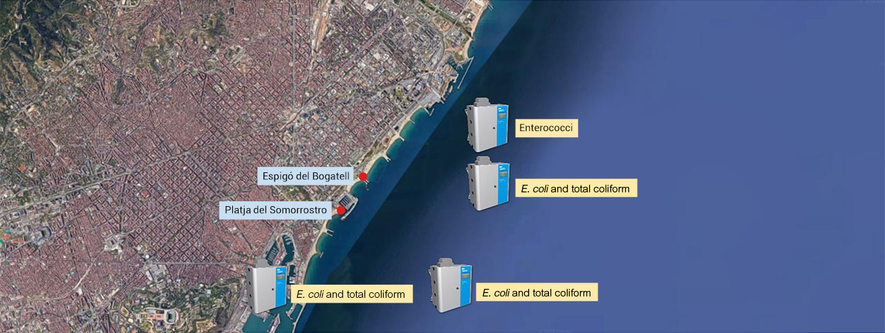
The equipment’s location
The project’s measuring equipment is located in Somorrostro beach and Bogatell beach.